
Colorado’s Northern Front Range includes lots of mountain bike trails that can be fun for everyone from beginners to experts. The following are trails we have documented with each ranked by difficulty within its region. Click a trail name’s link to view maps, pictures, videos, and more information about the trails or view a map of all Colorado trails we have explored.
- Boulder / Lyons Trails
- Fort Collins Trails
- Fort Collins / Loveland Trails
- Poudre River Canyon Trails
- Trails North of Pouder River Canyon
1. Valmont Bike Park – It has free parking and is located near downtown Boulder. It has several skills areas, each of which is designed for riders of varying skill levels and bikes.

2. Rabbit Mountain – It has 5.6 miles of trail and free parking. Eagle Wind trail is a 4.0 round trip ride with 350 feet in elevation gain and not very technical. It is a great place to visit for a quick ride after work.
3. Hall Ranch – It has 6.9 miles of mountain bike trails that include a mix of fast, easy single track and slow, challenging climbs over big rocks and around tight corners. Start from the Antelope trail’s free parking lot for a less technical and simply fun ride. Or, start from the Bitterbrush trail’s free parking lot for a challenging climb around and over rocky bends. Either way, it is a must-visit for all mountain biking enthusiasts because its varied terrain makes for an exciting ride.
Fort Collins
1. Mountain Bike Skills Parks in Fort Collins – Hone your skills at one of two mountain bike skills parks in Fort Collins. The Lory State Park skills park requires an entrance fee but has three areas (skills, pump, dirt jump) that support everyone from beginners to experts. The Spring Canyon Park skills area is more challenging and less beginner friendly. 2. Lory State Park Valley Trails – The trails that run along the eastern, western, and southern edges of the main valley in Lory State Park are a great place for a new mountain biker to start. Specifically, the single track trails form a 7.3 mile loop, are smooth, and include limited changes in elevation and manageable switchbacks. In addition, Horsetooth Mountain Park can be accessed from the South Valley loop to extend a ride. The aforementioned skills park is located near the eastern valley trail so new skills can be practiced before hitting the trails. An entrance fee is required to enter the park.
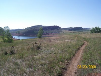 3. Maxwell to Pineridge Natural Areas – Riding from the Maxwell Natural Area to Pineridge Natural Area quickly became my favorite after-work ride because I was able to ride to the Maxwell entrance from my apartment. The 7+ mile loop is not very technical but does include some optional climbs. The Timber trail in Pineridge Natural Area offers a short stretch of technical single track. Parking is free and the trails are accessible from several locations.
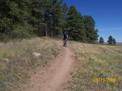 4. Maxwell to Reservoir Ridge Natural Areas – A six mile one-way ride from Maxwell Natural Area to Reservoir Ridge is a very challenging ride because the trail climbs the ridge three times and spans elevations from 5,200 to 5,500 feet. It starts with a challenging switchback climb up and over a ridge. The next stretch runs along the shoreline of Horsetooth Reservoir and is fast and easy. However, the approach to Reservoir Ridge is extremely rocky and can require several dismounts; including a few un-rideable stretches. Parking is free and the trails are accessible from several locations.
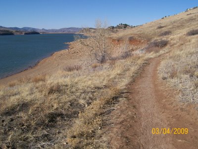
Fort Collins / Loveland
1. Blue Sky Trail – It is a 5.5 mile trail that connects Horsetooth Mountain Park to Coyote Ridge Natural Area and Devil’s Backbone Open Space. It is a rolling, curvy single track with one prolonged climb. Further, it is fun for mountain biking families and beginners because it is primarily smooth and fast with minimal numbers of rocks to maneuver around. Rides can be extended by connecting to Indian Summer and Rimrock trails. Parking at Horsetooth Reservoir requires an entrance fee but parking at Coyote Ridge is free. 2. Indian Summer via Blue Sky – Mountain biking from Horsetooth Reservoir to Indian Summer via Blue Sky is my favorite Colorado mountain bike ride because it is a fast ride with challenging climbs. Indian Summer is a 2.1 mile horseshoe shaped extension of Blue Sky that traverses open landscape at elevations ranging from 5,400 to 5,800 feet. It by itself is not difficult but getting to it takes some work because the only way to access it is via Blue Sky.
  3. Bobcat Ridge Natural Area – The 4.0 mile Valley Loop trail has about 300 feet in elevation change and offers short climbs and descents with minimal technical maneuvering. There are other trails at Bobcat Ridge that are more difficult but the Valley Loop is a great place to start. Parking is free.
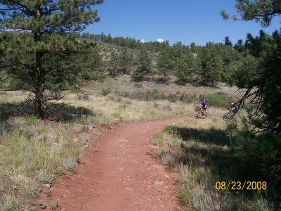 4. Coyote Ridge Natural Area – It starts easy but quickly becomes a long, steep 600 foot climb covering only 2.0 miles. I recommend this trail only if you are in biking shape because I showed up out of shape and got worked by the long climb. Coyote Ridge connects to Rimrock which connects to Blue Sky. Even though parking at Coyote Ridge is free, I recommend riding to Blue Sky from Horsetooth Mountain Park.
 5. Rimrock Mountain Bike Trail – It is 1.8 miles long and traverses elevations ranging from 5,400 to 5,600 feet. Biking east to west, it starts at Coyote Ridge Natural Area at approximately 5,600 feet in elevation. The trail is very rocky in spots and includes some staircases that required dismounting. By arriving at Rimrock trail from Coyote Ridge Natural Area, you have already mountain biked a tough 2.0 mile, 600 feet elevation climb so fatigue can be factor (at least it was for me). It can only be accessed from Blue Sky and Coyote Ridge.
  6. Crosier Mountain – It is a 4.5 mile trail with an elevation gain of 2,830 feet, from 6,420 to 9,250 feet. We only hiked the first ~2 miles with an estimated elevation gain of ~1,000 feet. It is open to mountain biking and would appear to be a very challenging ride because of tight, steep, and rocky switchbacks. However, 1.25 miles into the hike the trail levels off and would become an easier mountain bike ride. Parking is free.
Poudre River Canyon
1. Hewlett Gulch – It is my second favorite Colorado mountain bike trail because it has numerous stream crossings, long climbs, a mix of rock and dirt, and a serenely beautiful ravine as the backdrop. The main trail is 3.0 miles one way with a mild elevation gain from 5,600 feet to 6,200 feet. The additional unnamed loop is a continuation of the main trail, 2.6 miles long, and climbs 600 feet to 6,800 feet in elevation. The main trail is moderately difficult but the additional loop has stretches that are technical and steep. Parking is free. 2. Young Gulch – It is located a mile down the road from Hewlett Gulch so an ambitious rider can ride both in the same day. It is similar to Hewlett Gulch because of its numerous stream crossings and gradual incline but more difficult because the terrain is very rocky in spots with drops of up to two feet; one of which broke my rear axle. The trail is 4.4 miles long, single track, and gradually ascends from 5,800 feet to 7,100 feet.
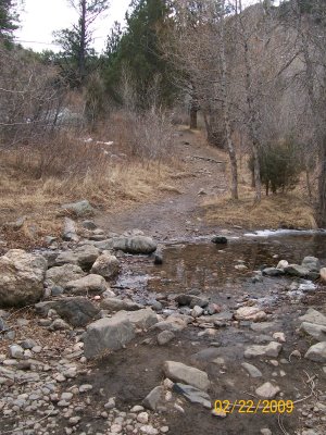
North of Poudre River Canyon
1. Mount Margaret – The trail is a wide, fast 4.0 mile ride with a limited elevation gain from 8,090 to 8,180 feet and, thus, it is a suitable for families and beginners. We hiked straight to Mount Margaret and its panoramic views but there are several 1.5 to 2.5 mile loops that branch off of the main trail and head to Dowdy Lake and Red Feather Lakes areas. Exploring the secondary trails would be easier on a mountain bike or horse as opposed to hiking on foot. Parking is free.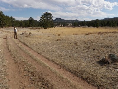 2. Red Mountain Open Space – I had the opportunity to hike in this park before it was available to the public but have not mountain biked in it. Based on my visit, it appears to have several fast, single track trails with limited changes in elevations. In addition, Soapstone Prairie Natural Area borders with the park so visiting both in the same day can make a long drive worth while. Both are worth further investigation.

Thx for information.
Nice site! Great information.