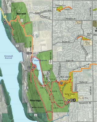
The beginning of the loop can start in three places identified with car icons on the following Google map:
- The Maxwell Natural Area’s northeast trail entrance,
- From a parking lot between the Maxwell and Pineridge Natural Areas,
- Or, at the Spring Canyon playground parking lot on the south eastern corner of the Pineridge Natural Area.
The bike loop line on the following Google map starts from Maxwell’s northeast trail entrance and runs counterclockwise. Google Maps estimates that this bike loop is 7.25 miles long.
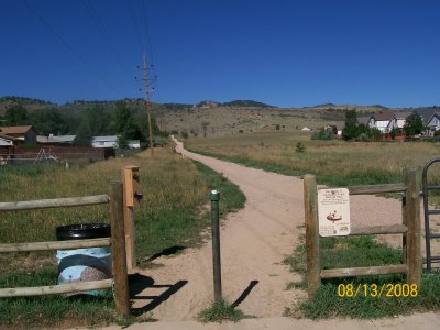
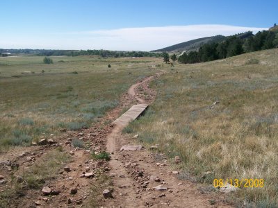
Northeast Maxwell Natural Area Trail Entrance
The following picture shows the northeast Maxwell Natural Area trail entrance that connects to Banyan drive near Prospect Road. The first stretch of trail is a long, slow incline with loose gravel.
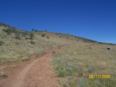
Foothills Trail North to Reservoir Ridge Natural Area
The Foothills Trail North, as seen in the following picture, leads to the Reservoir Ridge Natural Area. The very beginning of this trail has a steep incline with very technical spots to maneuver. This trail is not included in the Maxwell to Pineridge loop described in the rest of this blog post but can be read about here: Maxwell to Reservoir Ridge.
The following picture was taken at a three-way trail intersection in Maxwell Natural Area. The trail on the left side of the picture leads north towards Reservoir Ridge Trails, the trail in the center heads east to the Maxwell Natural Area trail head, and the trail on the right leads south towards Pineridge Natural Area.
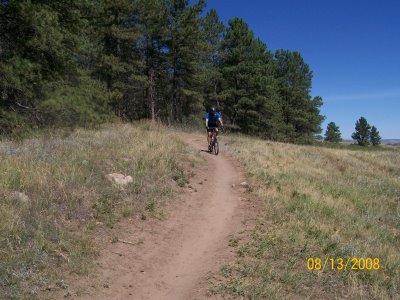
The Maxwell Foothills Trail is a short but fun mountain biking trail. For the most part, it is an easy trail but it does include a few bursts of technical jockeying.
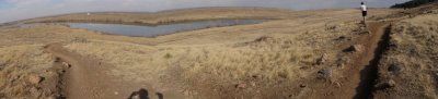
Pineridge Timber Trail
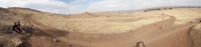
The western part of the Pineridge Foothills Trails is called Timber Trail and it runs close along the edge of the foothills. The following panoramic picture was taken at the north end of the Timber trail and includes Dixon Reservoir in the background.
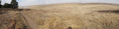
 The subsequent panoramic picture was taken from the middle of the Timber trail in Pineridge Natural Area.
 The Timber trail is more interesting than other parts of the Foothills Trail because it contains an eclectic mix of uphill, downhill, and technical stretches. In fact, I usually return heading north on Timber trail because it is the most of fun stretch of trail in Pineridge Natural Area.
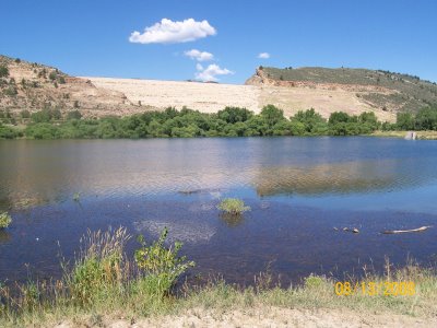
Pineridge Foothills Trail along Dixon Reservoir
Looping back north along the eastern side of the Pineridge Foothills Trail puts you on level ground with a view of the Dixon Reservoir and of a Horsetooth Reservoir damn structure (seen in the background).
Maxwell Foothills Trail along CSU Football Stadium
The final stretch of the loop rides fast and travels next to the Hughes Stadium which is home to CSU Rams Football team.

In sum, the Maxwell Natural Area to Pineridge Natural Area bike loop is a good ride for mountain bikers of all skill levels, includes great views, and a diverse mix of trail challenges. Further, it is a ride that many Fort Collins residents can start from their residences without having to drive their car to the trailhead. It should be noted that this loop offers very little shade or an opportunity to fill up your water bottle but it does provide several lavatories. The following is a list of more Colorado mountain bike trails along the northern Front Range.
