The Mount Margaret trailhead is located 20 miles west of Livermore, Colorado and 41 miles from downtown Fort Collins, CO. The trailhead is reached by taking US-287 north to Livermore, turning left on CR-74E (a.k.a., Red Feather Lakes Road), and driving 20 miles west on CR-74E to a parking lot on the north side of the road. The trailhead offers free parking including space for horse trailers but no restrooms, water, free dog waste bags, or trail maps. Primary activities on Mount Margaret trail are horseback riding, hiking, mountain biking, nordic walking, and hiking with dogs. Motorized vehicles are not allowed on the trail. In addition, cell phone service was not obtainable on the trail. The following Google Map shows the location of the first two backcountry camp sites and an estimation of the trail.
Mount Margaret Trail is 4.0 mile hike with a barely noticeable elevation gain from 8,090 to 8,180 feet. Many parts of the trail are remnants of old logging roads and, therefore, they are great for nordic walking because they are consistently wide and smooth. The trail is family friendly but can make for a long day if the summit is reached (i.e., 8 miles round trip). The elevation peaks about half way into the hike and then drops down to 7,900 feet at the summit. Thus, the hike to the summit is more of a downhill hike and the first half of the return hike is up an incline.
 We hiked but it appears that it would also make for an easy but fun mountain bike or horseback ride because there are several 1.5 to 2.5 mile loops that branch off of the main trail. Specifically, a couple of the secondary loops that branch of off head to the Dowdy Lake and Red Feather Lakes areas. Exploring secondary trails would be easier on a mountain bike or horse as opposed to hiking on foot.
 It was peaceful as we only saw a couple groups of hikers and one group of horseback riders. Further, the trail is accompanied by ponderosa pine trees that offer a limited amount of shade.
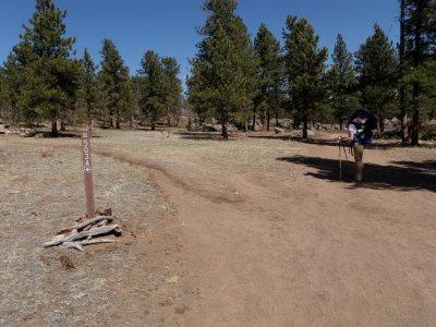
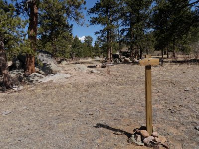
 Since the trail is not well marked it is important to pay attention to the trail signs. The Mount Margaret trail is labeled as 503. However, 1.65 miles into the hike we took a left onto a trail labeled 503A and then a few hundred feet later took a right to get back onto 503. Looking at Google Maps in satellite mode, it appears that if we had stayed right we would have been fine too. The following picture shows the intersection where we made a left turn but where going right should keep you headed to the Mount Margaret summit.
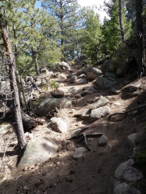
 The last stretch leading up to Mount Margaret summit is mildly rocky and is only pointed out because it is the only section that is not flat and smooth.
 The subsequent panoramic picture highlights the view to the north.
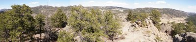 Further, the following picture shows the valley view to the northeast of Mount Margaret.
 The subsequent panoramic picture illustrates a distant view of Rocky Mountains to the south.
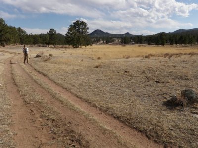
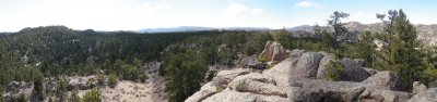 The hike from the summit to the trailhead is more scenic because the mountains to the south serve as a nice backdrop to the meadows; as is seen in the following picture.
 In sum, Mount Margaret is a very relaxing but long trail that is ideal for dogs, families, horseback riders, nordic walkers, mountain bikers, and anyone desiring a tranquil experience and a scenic summit.
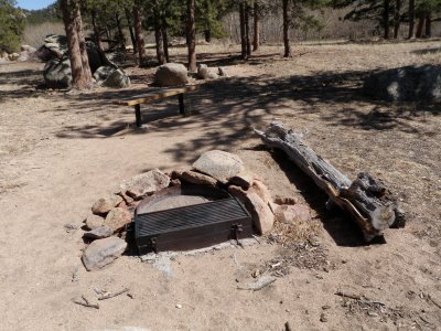
0.66 miles into the hike and shortly after crossing South Lone Pine Creek, you reach the first two of five backcountry camping sites. The sites are first-come, first-serve.
 We did not check out each site but they should all have a fire ring and bench as is seen in the following picture of camp site #1. Camp site #2 is across the trail from site #1 but we did not locate the other three sites. The backcountry sites are designated because they provide durable surfaces that can minimize the impact a camp group will have on the local ecosystem.

Thank you for a very informative description of the trail. Also appreciated knowing there are camp sites there.