The Mountains to Plains Project is a collaborative habitat conservation effort consisting of contributions from willing landowners, The Nature Conservancy, Larimer County Open Lands Program, Legacy Land Trust, the City of Fort Collins Natural Areas Program, and Great Outdoors Colorado. The project protects over 55,000 acres of land.
In June 2009, Larimer County’s Red Mountain Open Space and the City of Fort Collins’ Soapstone Prairie Natural Area become open to the public. The two properties are connected and bounded by the southern border of Wyoming and are expected to include 30 miles of interconnected trails. In addition, the City of Cheyenne owns 1,800 acres along Wyoming’s southern border that may include trails that connect with trails in Red Mountain Open Space and Soapstone Prairie Natural Area.
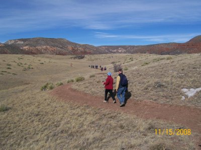
In November 2008, I attended the final tour of Red Mountain Open Space. The following description consists of imperfect information gathered on the hike and on the Internet. Trail names and locations are speculative since Larimer County’s trail construction has not completed. However, our pictures and videos accurately portray the beauty and tranquility of Red Mountain Open Space.
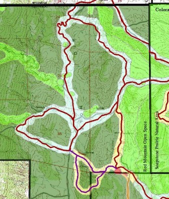
Red Mountain Open Space is a 13,500 acres park located 25 miles north of Fort Collins. It took us a hour to get there from downtown Fort Collins because it sits directly in between I-25 and US-287. Primary activities are expected to include hiking, mountain biking, horseback riding, nordic walking, birding, and trail running but walking leashed dogs are not allowed. Parking is expected to be free. Due to its remote location, I imagine that restroom facilities and water will be provided. Cell phone service was weak or non-existent leading up to and inside the park. The subsequent Google Map includes the approximate trails we hiked on the tour but some may not become public. Most of the trails appear to have elevation changes of less than 400 feet starting at around 6,300 feet. The management plan states that elevation on the property ranges from 5,900 feet to 7,458 feet.
The following picture contains a subset of the planned trail system. Purple trails are for hiking only and red trails are for hiking, mountain biking, and horseback riding. The complete planned trail system will include connections to Soapstone Prairie Natural Area.
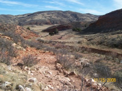
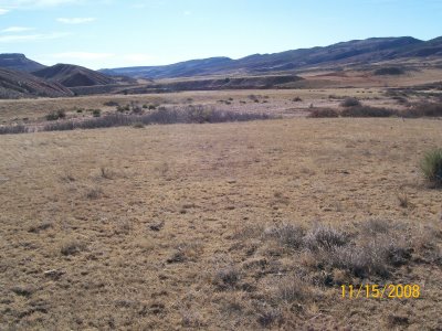
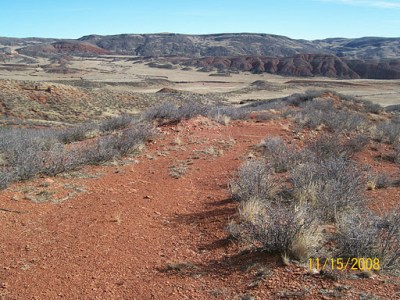
The first trail we hiked was about 0.75 miles long with an elevation gain of 300 feet. The gain in elevation was enough to provide a stunning view of Big Hole valley as seen in the pictures below.
 Red Mountain Open Space is located in an ecotone and, specifically, is a transition zone between central short grass prairie and Rocky Mountain foothills. Transition zones are important to conserve because they are biologically diverse. Plants and shrubs that can be seen near the trail include great plains yucca, rubber rabbitbrush, true mountain mahogany, plains prickly pear cactus, and fringed sage.
 In addition, this area is home to mountain lions, elk, coyote, nesting golden eagles, red-tailed hawks, prairie falcons, great-horned owl, bald eagle, pronghorn, black-tailed prairie dogs, bobcat, black bear, Preble’s meadow jumping mouse, and mule-deer.

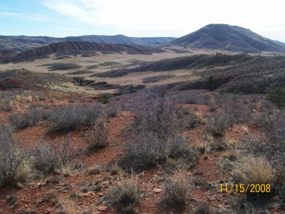
Big Hole valley is a vast expanse that makes up a large part of the park. It is is expected that there will be a valley loop trail that runs along the edges of it. Its wide open landscape is incredibly dry and windy, and promises to be hot in the summertime. Adequate water and sun care are highly recommended for all visits. The following videos capture the roar of the wind. The first video is of the southern half of Big Hole and includes a view of Table Mountain. At this time, there are no planned trails for the summit of Table Mountain.
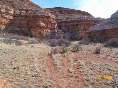
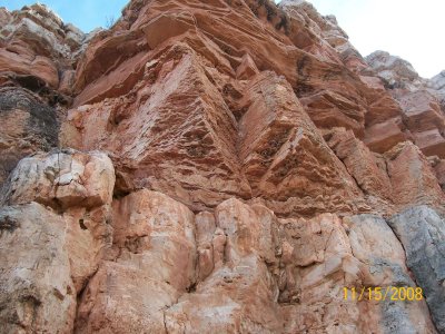
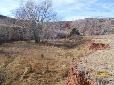
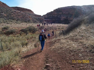
Bent Rock Trail is a 2.4 mile loop that runs through a small canyon and then along the base of Table Mountain. Boxelder Creek and Sand Creek bisect the park providing important riparian habitats for plants and animals. It is expected that Haygood Canyon at the northwest corner of the park will remain off limits to protect its ecological constituents. The following pictures are from the trail that starts from Big Hole and follows Sand Creek east through a small canyon which resulted in a 1.2 mile hike.
 The canyon is embedded with interesting geological formations that are sure to be the topic of future guided naturalist hikes. This park contains geological history spread over 1.8 billion years.