
Dragon’s Tooth is located west of Roanoke, Virginia. From Blacksburg, directions are: take Mt Tabor Rd (State Route 624) north, left on VA-311, and a quick left at the sign for the trail. Hiking and camping are the primary activities on the trail. Parking is free with restrooms and a large lot but water is not provided. Cell phone service was intermittent. The following Google Map shows a loop hike that includes the Dragon’s Tooth Trail, Appalachian Trail, and Boy Scout Trail.
The hike on Dragon’s Tooth trail from the parking lot to the summit is 2.5 miles and a climb of 1,100 feet. The elevation chart shows the complete loop of AT and Boy Scout Trails.

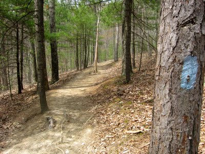
The Dragon’s Tooth trail is 1.5 miles and a steady climb. It includes two easy stream crossings.

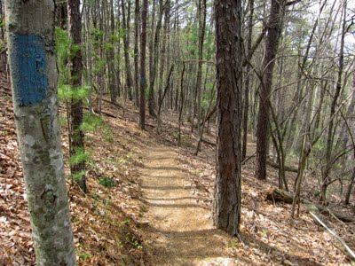
The trail is very smooth, can support fast hiking, and would be good for kids. The first mile and half of trail is denoted with blue blaze markers.
After a mile and half, it intersects with the Appalachian Trail. From the intersection, hike on the AT south for an additional mile to reach the summit. The slope on this section is constant but the AT trail is uber rocky. I don’t recommend taking toddlers on this hike because it is strenuous and too rugged.

In the middle of the trail I spotted these purple flowers. Some had five light purple petals and others had three light purple and two dark purple with a velvet texture. I believe this flower is a birdfoot violet. Do you agree?

As I approached the summit, I came across an increasing number of sections where I needed to use my hands to support climbing up and over rocks.
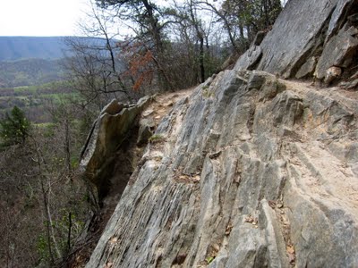
What’s more, there are two rock faces with man-made metal steps built into them.

The summit area has plenty of space for a picnic. I used a LunchSkins sub bag (instead of a single use plastic bag) to carry my peanut butter and jelly sandwich. I met a lady who said that the summit is one of her favorite places to backcountry camp. The Dragon’s Tooth rock can be climbed by walking around to the south end and then bouldering north.

As can be seen in the next picture, the top of Dragon’s Tooth is narrow and, thus, I don’t recommend bouldering it unless you are a trained rock climber. Notably, I saw several raptors hovering above but I was unable to identify them.

The following video shows the 360 degree view from the summit. It is a little shaky because there wasn’t much room with which to rotate my body while filming.
Be sure to hike down the mountain on the Appalachian Trail north because the south trail will lead you away from the parking lot. The same lady who likes to camp at the summit also recommended that I make a loop out of this hike by taking the AT south to the Boy Scout Trail (which connects to the Dragon’s Tooth trail near the parking lot). I heeded her suggestion and recommend the same to you because the section of AT that connects to the Boy Scout Trail is more scenic than the Dragon’s Tooth Trail. However, hiking a loop will take longer and the AT is rockier than the Dragon’s Tooth trail. Follow the AT white blaze makers for about 1.5 miles until you see a sign for the Boy Scout Trail.

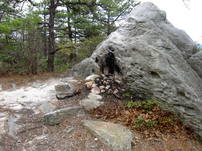
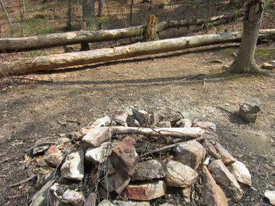
I saw two potential backcountry camp sites on the section of AT trail that leads to the Boy Scout Trail. The first, seen below, is smaller and felt windy.
The next picture highlights rhododendron hanging over the trail.

The subsequent is one of the many views to the north that can be experienced by hiking the loop.

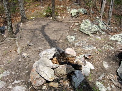
The second camp site was larger and appeared to be heavily used. I marked this camp site on the Google Map above.
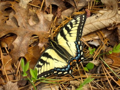
I was lucky enough to snap a closeup photo of a swallowtail butterfly. The last time I had seen one was at Woodpecker Ridge.
At a clearly marked intersection, I took a left to get onto the Boy Scout Trail. It is identified with blue blaze markers. It is a smooth trail that gently descends.
The Boy Scout Trail ends at an intersection with the Dragon’s Tooth Trail and which includes a large camp site.
In sum, the hike to Dragon’t Tooth is challenging because of its steep slope and rock outcrops but the view at the top is rewarding. Two other challenging adventures on VA-311 include hiking McAfee Knob and mountain biking Dragon’s Back. Another AT day hike to check out is Angels Rest in Pearisburg, Virginia.

I just wanted to say thank you for such a great hike description! I am hoping (if the weather holds up) to head out this weekend for Dragon’s Tooth, McAfee Knob, and Tinker Cliffs and this is great reading to get me in the mood 🙂 Thanks again – and happy hiking!
You’re welcome and thanks for reading. I’ve documented my trips to McAfee Knob on this blog but have not been to Tinker Cliffs. I hope it turns out to be a fun adventure for you!
I just hiked to the top of the Tooth yesterday. I can’t believe you did a 360 view from the top – I can just see you turning around on that rock to get the full view. Wow!!!! I could barely sit without feeling like I would fall, let alone video 360. I did take some pictures and video though.