
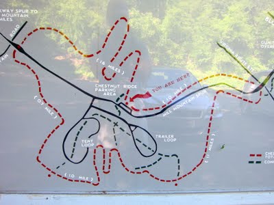
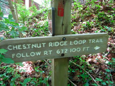
Chestnut Ridge Trail and Roanoke Mountain Campground are located on the Mill Mountain Parkway between the Blue Ridge Parkway and the Mill Mountain Discover Center. Activities on the trail include hiking, dog walking, trail running, and horseback riding but mountain biking is not allowed. Park for free at the large Chestnut Ridge Overlook parking area or walk to the trail from any of the camp sites at the Roanoke Mountain Campground. The campground has water and restrooms but the Chestnut Ridge Overlook does not. Cell phone service was at medium strength on the trail. I made a wrong turn so the Google Map below does not show the full Chestnut Ridge Loop but instead includes a long detour on a trail that parallels the Blue Ridge Parkway.
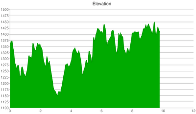
The Chestnut Ridge Loop Trail is 5.4 miles long with very little change in elevation. The following elevation chart includes my long detour outside of the designated loop but effectively illustrates the loop’s level slope.
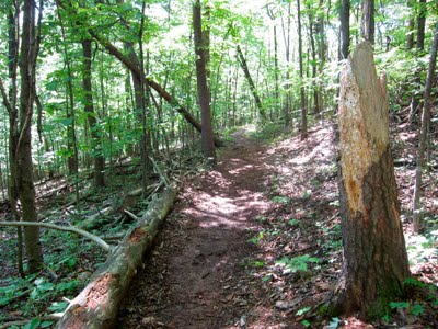
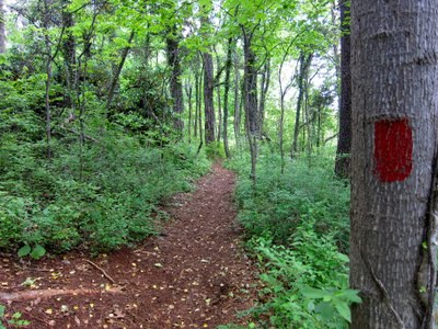
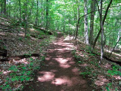
The trail is smooth which makes it good for fast hiking, young kids, trail running, dog walking, and horseback riding.

The forest canopy was dense and boasted an assortment of birds. I am not a trained birder but saw and heard numerous species. The high level of bird activity surprised me since they are usually most active in the morning and I was hiking in the middle of the day.
I attempted to hike the 5.4 loop clockwise starting from the Chestnut Ridge Overlook. After about a mile, I came to the following intersection near the Welcome Valley Road. In the picture below, the trail splits in a Y-shape with both segments heading towards Welcome Valley Road.
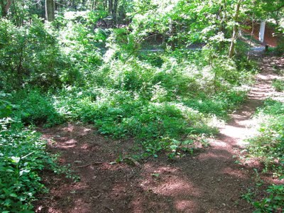
From looking at the trailhead map, I assumed that I needed to cross a road to stay on the trail. To the right, I did not see a trail on the other side of the road but to the left I did. The following sign explains the correct course of action but I experienced three problems. First, the sign should be located where the trails forks instead of being located farther along the right side of the fork.
Second, the sign was partially blocked by plants.

Third, I assumed that I needed to cross a road when what I really needed to do was go under one! A closeup of the map shows the spot where I should not have crossed Welcome Valley Road.

The correct thing to do is stay to the right, walk along the road, and hike under the overpass seen in the next picture.

As a result of my mistake, I hiked on a trail that parallels the Blue Ridge Parkway and that passed the Gum Spring Overlook. This trail appeared to be heavily used by horses and was similar to the Chestnut Ridge trail (minus the red blaze trail markers). It was on this extended trail that I saw my first wild turkey.

After correcting my mistake, I made to sure to follow the red blaze trail markers.
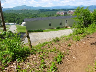
The western half includes a small opening that offers a striking view to the west.
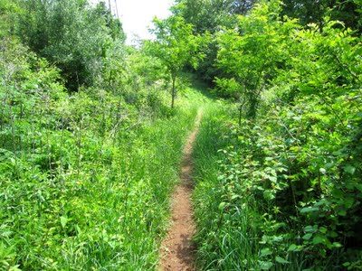
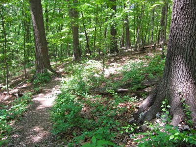
It is similar to the eastern half in that it is wide and heavily shaded by trees. However, it does include a short segment that was narrow and overgrown with vegetation such that I wished I had worn pants (to protect against ticks).
The western half includes several intersections with trails that lead in and out of the campground. In addition, the eastern half of the trail can be accessed across the street from the campground’s entrance. The trail’s tight integration with the campground results in an opportunity to hike on it from any camp site and to design a custom loop that meets your needs (e.g., kids, dogs).
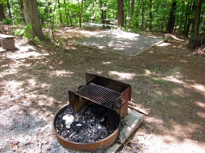
The Roanoke Mountain Campground tent sites include a picnic table, a fire pit, and a square area for setting up a tent. The tent sites are clustered closely together in groups of three or four. It seems like it would be more fun to camp with a group of friends using all of the sites in a cluster as opposed to camping as a single family with people you don’t know only a few feet away. Also, it appears that the sites are first come, first serve.
I did not complete the designed 5.4 loop because my detour included an additional six miles. Instead, I cut through the Roanoke Mountain Campground, crossed the street at the campground entrance, and picked up the trail leaving about a half mile of hiking to the Chestnut Ridge Overlook parking area.
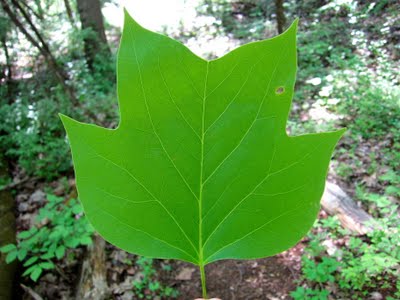
As you hike, I recommend looking for fallen Yellow-Poplar leaves because they are easy to identify with their unique flattened, square-like top edge.
I was lucky enough to find a fallen branch from a blooming Yellow-Poplar.

In sum, the Chestnut Ridge Loop Trail is easy to hike and ideal for dog walking and horseback riding. It is a fun complement to the Roanoke Mountain Campground because from the campground it is easy to structure a hiking loop significantly shorter than 5.4 miles. I recommend the Mill Mountain Star Trail for a more scenic hike. Finally, nearby mountain biking trails can be found at Mill Mountain and Explore Park.

I hope someone has done trail maintenance since I hiked on it last time, The trail was closed in way too much and I got poison ivy or oak from it.
Thank you for your info and summary on your hiking experience here.
I hiked this shortly after the storm: The trees were scattered and became obstacle courses covering the trail. Mud puddles called out to me but I didn’t dare give in. The smell of fresh rain was beating down on me. It was quiet. So quiet that the deer could not hear me running by as there were no leaves to crunch on the soggy ground. As I leaped over the last tree in my path I noticed the sun beaming through the trees uncovering the shadows. What a beautiful sight. Beauty surrounds us. There is beauty in nature. There is beauty hiding in the mountains of Virginia. There is beauty at Chestnut Ridge Loop Trail.