Greyrock Trail is located directly of off CO-14 about 30 minutes from downtown Fort Collins, CO and has parking for 20+ vehicles. Greyrock Mountain is in the Poudre River Canyon (pronounced Poo-der). Primary activities are hiking, hiking with dogs, and backcountry camping. Horseback riding, mountain biking, and motorized vehicles are not allowed on the trail. The free parking lot has restrooms but cell phone service was weak and I do not remember seeing any drinking water.
My camera’s flash failed me so I adjusted my picture of the Greyrock trail map as best as I could.
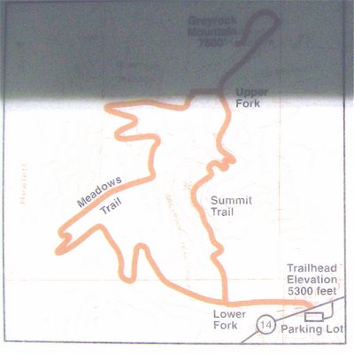
Hiking to the summit can be done via the 2.8 mile Greyrock Summit trail or the 3.8 mile Meadows trail. We choose to hike up the Meadows trail and return by way of the Summit trail. Either way, the elevation gain is 1,900 feet, starting from 5,580 feet and climbing to 7,480 feet. There are many narrow sections of trail with western poison ivy and, thus, it is important that you are able to identify and treat it should you be exposed. The poison ivy is most densely populated along the first 0.6 miles of the trail (i.e., before the trail forks). The Greyrock trail system is maintained by the Colorado Mountain Club and US Forest Service so please support these two organizations.

We chose to hike up the Meadows trails because it was classified as less strenuous than the Summit trail. However, since the last leg of the summit trail requires significant mental and physical energy, I recommend hiking up the shorter Summit trail and returning by way of the Meadows trail. You cannot go wrong either way because the Meadows trail is fun in that it twists and turns its way up to a scenic ridge. However, do not let the name fool you because the beginning of it is vertically challenging and does not flatten out until you get on top of a ridge.
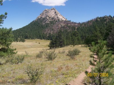
 The highlight is reaching a meadow that lays up next to the summit, as seen in the following picture. There are many shaded areas near the meadow that are perfect for picnicking. As illustrated in the map above, this trail connects to the summit trail via the southern side of Greyrock Mountain.
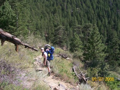
The last leg of the summit trail is a 0.75 mile hike that wraps around the east side of the mountain all the way to the north side before the final ascent straightens out and turns south. This last stretch is very challenging to navigate because the terrain is ambiguous. Thus, you must carefully navigate it by following the cairns along the edges of the trail. Cairns are piles of rock used as trail markers and, in this case, must be followed meticulously. Otherwise, you will find yourself bouldering up dangerous rock faces. Trekking poles would definitely help but carrying a Kelty child carrier is not recommended.
 The summit has a body of water rarely seen this high up and is viewable in the subsequent picture.
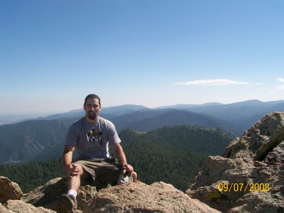
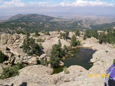 The summit provides about a 360 degree view of Poudre River Canyon.
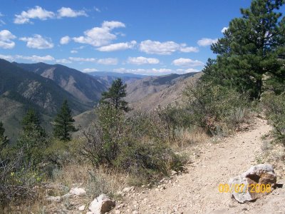
Returning on the 2.8 mile Summit trail felt easy and was hiked quickly. The trail bobbed and weaved in and out of trees providing both shade and scenic views of the Poudre River Canyon to the east.
In sum, the difficulty of this hike is moderate until you reach the last 0.75 miles, at which point navigating the trail becomes challenging and, thus, I recommend conserving both time and mental energy for this final stretch. Also in Poudre Canyon, you can mountain bike in Young Gulch and Hewlett Gulch and hike in the Gateway Natural Area.

Nice work on the Grey Rock guide Robert. Cool…I can see my house in your 360 video! I get a nice view of the top of the mountain from my house.
Tim, awesome…you are lucky to live so close to Greyrock!