Young Gulch is a part of the Arapaho and Roosevelt National Forests and is located in the Poudre Canyon. The trailhead is about 35 minutes from downtown Fort Collins, CO and has free parking for 15+ vehicles. Specifically, the trailhead is located on the south side of CO-14 about 200 feet east of the 109th mile marker, which is 13 miles from US-287. The primary activities are mountain biking and dog walking but horseback riding, hiking, cross-country skiing, backcountry camping, and hunting (off trail) are also allowed. Motorized vehicles are not allowed on the trail. Pet waste bags are not provided so please bring your own. In addition, restrooms and water are not provided. Finally, cell phone service was not available. Other trails in the Poudre River Canyon include Seaman Reservoir Trail, Gateway Natural Area, Greyrock Mountain Trail, and Hewlett Gulch. Hewlett Gulch is an easier mountain bike ride than Young Gulch so I recommend riding it first. The following Google map contains a car marker for the trailhead and a mountain bike marker for the end of the trail.
Young’s Gulch Trail is 4.4 miles long, single track, and gradually ascends from 5,800 feet to 7,100 feet. The trail makes for an easy hike or dog walk. However, on this day, I mountain biked Young’s Gulch trail so I will describe it from a mountain biking perspective. The trail heads south following Young Creek and crossing it over three dozen times. The creek crossings make for a fun, wet experience. It should be noted that human feces should be buried six to eight inches below the ground and 100 feet (50 steps) from the creek.
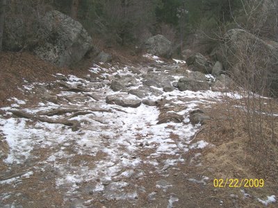
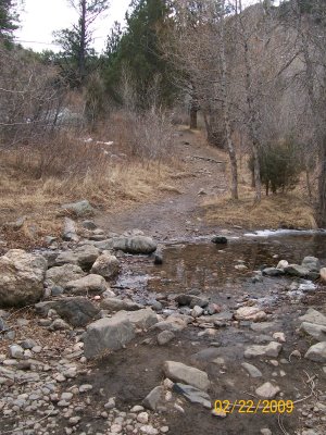 The first mile or so of trail is rugged and required several dismounts, mainly due to clusters of large rocks. Further, many of the larger creek crossings were frozen when I was there so their difficultly was tough to assess. The rocky terrain may have been more difficult the day I went because of the snow but the creek crossings were probably easier since they were frozen and flat.
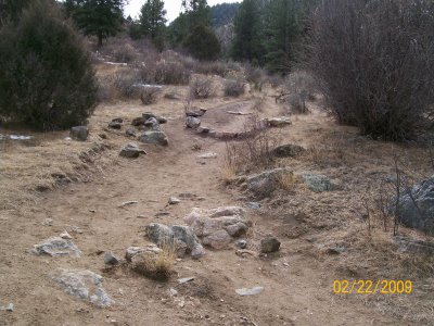
 The trail meanders in and out of forest canopy. Stretches of trail in open landscape generally consisted of easy mountain biking, as seen in the following picture.
 However, several stretches of the trail are rocky and narrow, making for a technical mountain bike ride.
 Much of the trail is shaded by forest canopy but there are enough open areas to warrant sun protection. Further, the trailhead recommends that check yourself for wood ticks in the spring and summer and, therefore, to use bug repellent to reduce the risk of a tick bite. Further, caution is advised during the fall because black bears are actively foraging. Even though mountain lions inhabit the area, they are rarely seen.
 The terrain of becomes less rugged the farther you ride and, thus, the trail becomes less technical and a little faster. Referencing the map above, the second half of the trail leaves Young Gulch and heads up Stove Prairie Gulch.
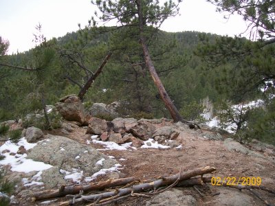
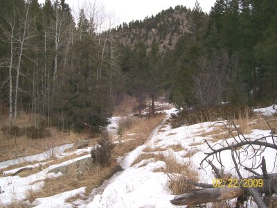 There are two pronounced climbs during the mountain bike ride. The first climb (not pictured) is technical because of a 90 degree turn and some rocks. The second climb (seen below) is long but not very technical. I was unable to complete this climb on my bike because my tires kept slipping in the snow.
 The trail ends at a private property boundary overlooking Stove Prairie Road. It includes a site that may be suitable for backcountry camping but is located very close to private property. The view from the end of the trail is limited due to its low elevation.
 In sum, Young’s Gulch trail is a challenging mountain bike ride because of its rugged terrain and potentially numerous dismounts. However, the trail’s elevation climb is very gradual and its terrain becomes less technical the farther you ride. Read our full list of mountain biking trails for more fun along the northern Front Range.

There is NO ACCESS to the trail from Stove Prairie Road. Parking on private property and in private drives is strickly prohibited.