Mt. Aire is located in Mill Creek Canyon. I drove to the trailhead by following Mill Creek Canyon Road about six miles and found a small parking area on my left. A park fee or prepaid pass was required upon exiting the canyon. Hiking, trail running, horseback riding, and dog walking were allowed on this trail but mountain biking was not. A restroom was provided but not water. Cell phone service was intermittent but my GPS signal was strong.
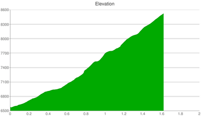
Hiking to the summit of Mt. Aire was a steep 1.8 miles with an elevation gain of almost 2,000 feet. The following elevation chart illustrates the trail’s consistently unrelenting slope.
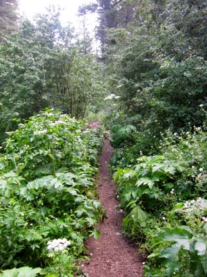
In August 2010, I hiked on the Little and Big Water trails in Mill Creek Canyon. I had so much fun in the dense forest landscape that I wanted to see what it was like to summit a peak in the canyon. I chose Mt. Aire because it seemed like the easiest path to a peak. The first section of trail had strong smells, a running stream, and overhanging vegetation that soaked my clothes because of recent rain. I made out fine in shorts but will consider pants for my next visit.
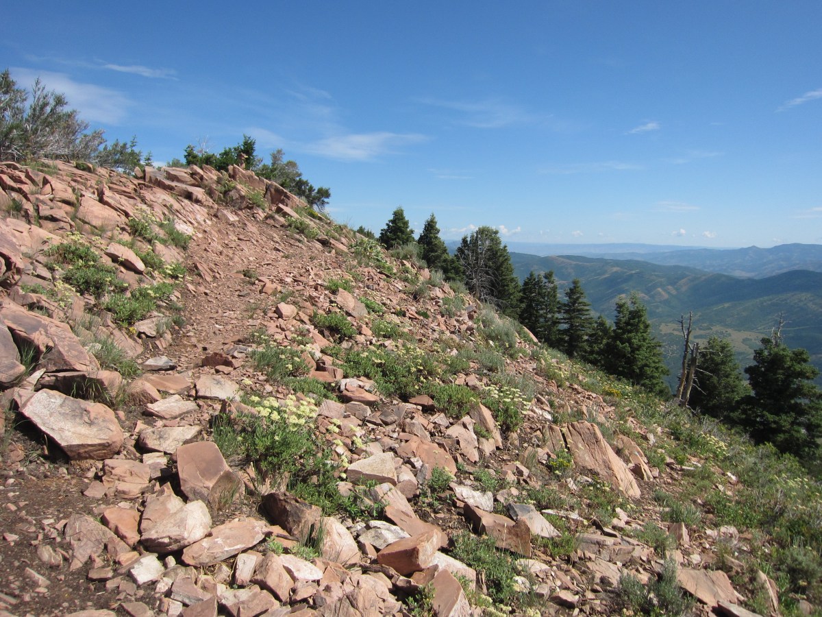
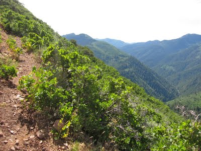
The trail was not marked past 0.2 miles. I stayed to the left at the first trail intersection. The trail had two distinct parts. The first part was smooth, steep (i.e., 900 feet elevation gain), and straight (i.e., no switchbacks).
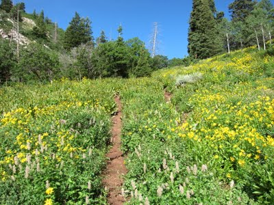
The trail boasted wildflowers and dense vegetation. I believe the following was in the sunflower family. As seen in the previous picture, there were hundreds of them.

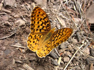
I also saw two eye-catching butterflies. The first was orange and black. I think it was a Fritillary (i.e., an orange-brown nymphalid butterfly).
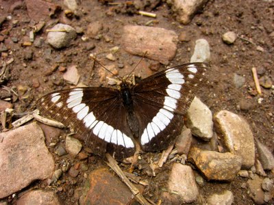
The second was black and white. I believe it was a Weidemeyer’s Admiral.
The first part of the trail ended at a level clearing that offered views to the north and south. I talked to a trail runner who said she runs up to this spot and turns around. The clearing had an unmarked intersection of trails. I took the right-most trail to reach the summit of Mt. Aire.

After turning right, I could see Mt. Aire directly in front of me.
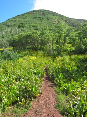
The second part of the trail began with the aforementioned right turn and also gained about 900 feet in elevation. It was an easier climb than the first 900 feet because it had several switchbacks that dampened the slope. However, it was rockier and along a steep edge.
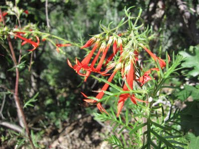
Nearing the summit, I saw bright red wildflowers which I believed to be scarlet gilia.
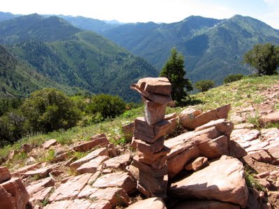
The summit was marked with a cairn and offered plenty of space to enjoy a relaxing picnic. My new favorite way to carry my peanut butter and jelly sandwich was in a LunchSkins reusable sub bag.
I took a panoramic picture with my Olympus Stylus Tough.
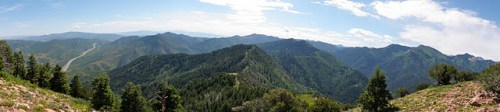
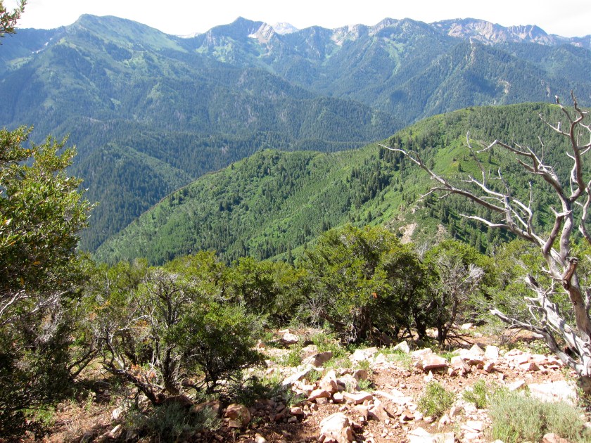
The summit was a large, wide open ridge with a 360 view that included I-80, Mill Creek Canyon, and the greater Salt Lake City area.
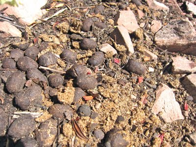
Near the summit, I came across the following droppings which I believed were from a moose. The first time I saw a moose was at Silver Lake.
The hike down included spectacular views in every direction.
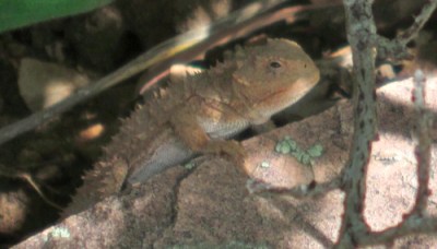
Not far from the summit, I saw several black birds with a touch of blue but was unable to identify them. In addition, the following lizard caught my eye as it scurried across the trail. At first I thought it was a horned toad but, after closer examination, I believe it was a pygmy short-horned lizard.
In sum, the hike to the summit of Mt. Aire was both vertically challenging and rewarding. I highly recommend it because it offers stunning views and a plethora of wildlife and vegetation. Another Mill Creek Canyon hike I am interested in is the trail to Lambs Canyon Pass, which starts from the same trailhead as Mt. Aire.

Wow that elevation chart is at a near perfect 45. And the switchbacks don't seem to soften It too much. But it does look worth it. Thanks for the post!
At 1.6 miles long the trail is equal to 8,448 feet long. The elevation gain is approximately 2,000 feet. The average slope of the trail is 2,000/8,448= 23.67%, not 45%.
Steven and Eric, thank you for the comments. The elevation chart was generated by the MyTracks application on my Google Android phone. The elevation readings can be off by hundreds of feet and are less accurate than the recorded GPS coordinates. However, a set of elevation readings should generate a chart with an accurate representation of incline and decline, which in this case is the fact that the trail is uphill the whole way. Hopefully, future Google Android phones will be able to generate more accurate charts.
The only way the charts would be accurate is if the scale on the x and y axes were the same. If not, there will be vertical exaggeration, which is the case here.