
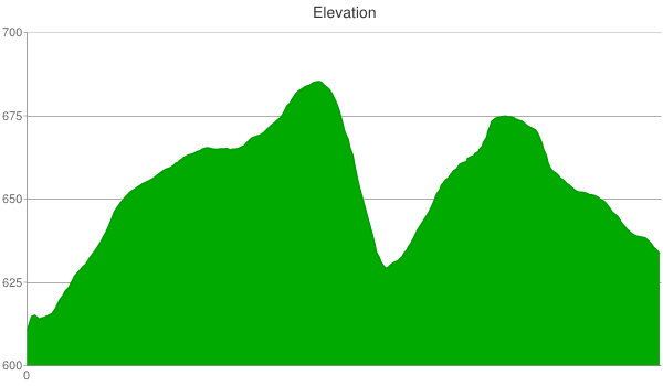
The Sugar Bottom Recreation Area is located east of North Liberty, Iowa and near the eastern shoreline of Coralville Lake. Directions from I-80: take I-380 N to exit 4 (North Liberty), from the exit ramp turn right onto 250th St, turn left onto N Front St, take the first right turn after crossing Mehaffey Bridge, and turn left into the disc golf/beach parking area. The parking lot was large and free, but donations were appreciated to support trail maintenance. There were two sets of restrooms that were open in warm weather. One of them had a water fountain and a soda machine. There was a second, smaller parking lot on the east side of the park and which was accessible from Sugar Bottom Rd. Read about high water access for times when the lake has flooded the gravel road. Outdoor recreation includes hiking, trail running, and mountain biking but not horseback riding. Cell phone service has always been weak for me as I receive text messages but not phone calls. The map below displays one full lap for the 2013 Scramble race course with five additional markers denoting spots that give me trouble.
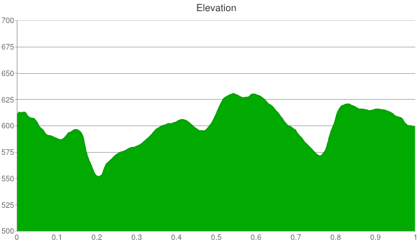
The first race lap starts at the shelter and then traverses 201, 202, 203, 205, 301 (skip peninsula loop), 303, 304 (partial), 105, shelter, 101, 102, 104, 104x, 101, 105, and ends at the shelter. Subsequent laps traverse 101, 102, 104, 104x, 101, and 105. For me, the four trickiest spots are the descent near the end of 303, the last climb and turn on 104, cyclocross hill on 101x, and the sharp left turn at the end of 101. Novices will not ride on 104 and 104x. The following elevation chart was recorded while riding the first full lap. It was 9.7 miles long with an elevation range of 150 feet.

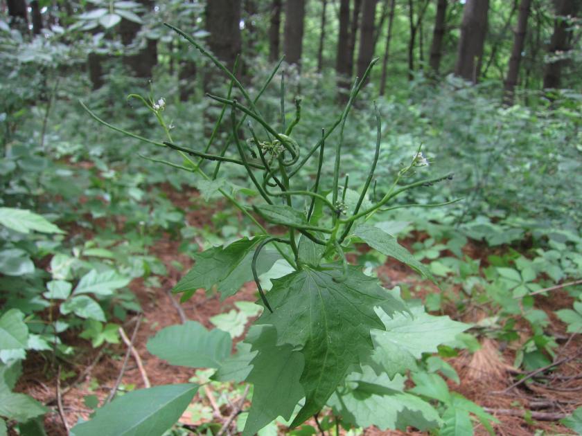
I moved to Iowa City in July 2011. Before moving to Iowa, I lived in Blacksburg, Virginia and Fort Collins, Colorado. I first mountain biked at Sugar Bottom in August 2011 and was immediately impressed with the trails. They are very well maintained, fast, and fun. Before entering and exiting the trail system it is encouraged to gently rinse your bike at the wash station to prevent the spread of Garlic Mustard, a non-native invasive plant.

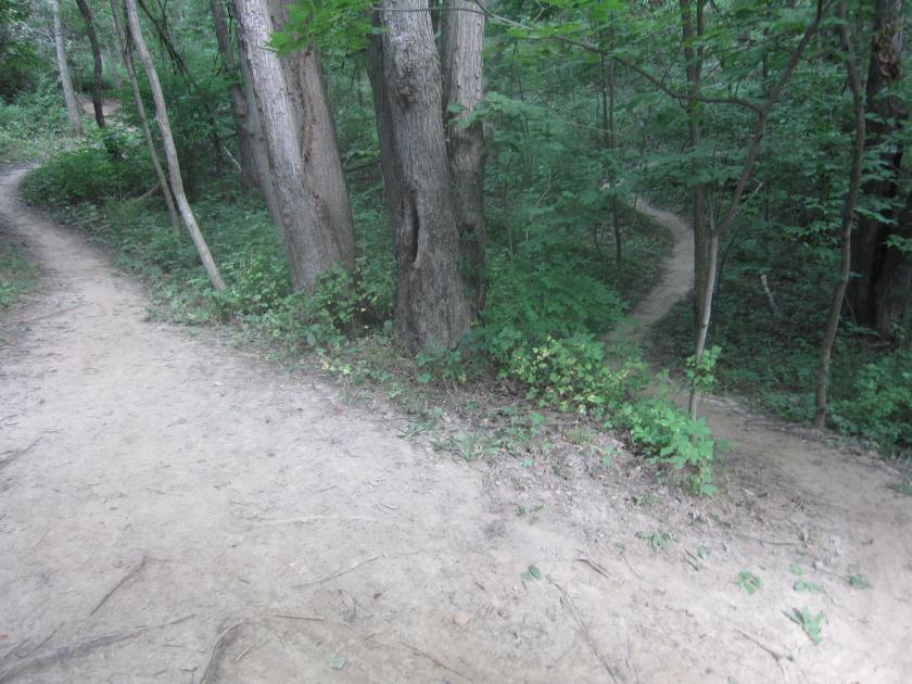
The fire road is multi-directional but all of the numbered trails are one-way and clearly marked as so.

The northern set of trails are numbered 100-105 with 101, 102, 104, 104x, and 105 included in the Scramble race course.
The beginning of 101 was near the fire road. It was flooded as recently as June 2013; read about high water access for more info. It was hilly and two miles long.
 It has an uphill right turn that was partially obstructed by a fallen tree. It took me several tries but I finally mastered it. In summer 2012, this tree was cut up and pushed away from the trail.

In Spring 2013, work was done to reroute it so as to limit the impact of future flooding (e.g., see the bridge in the next picture).

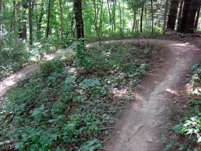
Trails 102, 103, and 104 are loops that branch off of the northwestern corner of 101. 102 started with a climb that ends at a tight switchback (seen below), after which the remainder of it was a fast descent.
In Fall 2011, 102 was rated “more difficult” because of a rocky section and a moderately challenging s-curve climb. However, as of June 2012, a new route was added that makes it easier and more fun.

103 was rated “most difficult” because it had two steep drops, two tough climbs, and some tight turns. The first steep drop was near the beginning and had gnarly tree roots protruding in the middle of it.


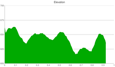
104 is also rated “most difficult”. It feels like the hilliest trail in Sugar Bottom and the following elevation chart affirms that feeling.
 It started with a long descent around elongated corners.

After a stretch of relatively flat terrain, it gradually ascended near to where it started. The first challenging feature of the race and the only part of this trail that trips me up was the last left turn because it was sharp, steep, and slippery (due to leaves).


After 104, the race course resumed on 101. The following is an example of the many wide turns in the trail system, albeit this one had more around-the-corner visibility than most.
101 had a series of low lying bridges that were not intimidating.

On the other hand, in July 2013, a large and intimidating log ride was added.

The second challenging feature of the race course was cyclocross hill (trail 101x). It started with a sharp drop and then finished with an even steeper hill. This was the only section that was too steep for me on my single speed Niner SIR 9, although I’m not sure I’d be doing it on a multi-speed. Racers have been seen “catching air” at the top of it so it was a fun place for spectators to sit and watch.

If you’re not riding the race course then you can bypass cyclocross hill by crossing a bridge constructed in October 2011 (seen below).

The subsequent picture illustrates a short gnarly climb and the third challenging feature of the race. It was located at the very end of 101 and hidden by a blind 90 degree left turn. After many failed attempts, I recommend riding hard down the middle as opposed to trying to ride left of the tree roots.

In the summer of 2013, a new log ride was added to the end of the blind left turn above.

Mixed in between the challenging features were stretches of fast single track.
 At the end of 101, the race course connected to 105 just before it reached the main fire road. It was less than a mile long but has some tough climbs.

The bridge on 105 has a moderately tricky entry point because it was downhill and shadowed by a dead end trail on the right.

The bridge sat at ground level.

The race concluded with a grassy ride on 105, which ended at the picnic shelter.

In Fall 2013, a high school student built a skills area comprised of elevated wood ramps, rock gardens, and low lying logs. It was located several hundred yards east of the picnic area and visible from the fire road.

The southern set of trails are hillier and curvier than the northern set. They are numbered 201-205 and 301-304. The 2013 race course traverses all of them except 204 and 302.
201 was 1.4 miles long and served as a main artery that connected sub-loops 202, 203, 204, and 205; and ended at the start of 301.

It was curvy but rode fast.

202 was a 0.2 mile loop with two short climbs.

Like most of the easy trails, it was smooth and narrow with wide turns.

203 was a 0.5 mile loop.

It was similar to 202 but slightly more challenging.

204, also named “Hell Trail”, was a challenging 0.8 mile ride that connected the two halves of 201. As the elevation chart below illustrates, it started with a long descent, had several short ascents, and then ended with a climb. It along with 104/104x are my two favorite trails.

It had a wood ramp that was good for people looking for an additional challenge but that was optional.

It featured a large fallen tree with exposed roots.

The Hell Trail was more challenging than the others in the southern half of the system because it had tighter turns atop steeper slopes. Specifically, the latter half had several steep s-curves. The first was challenging but a little easier than the rest.

The second was a steep right turn followed by a tight left turn.

The challenging s-curves continued until it ended. I ride this trail every time I visit because it serves as an indicator for how well I’m doing. I have conquered the first 90% but have yet to ride the entire thing without dismounting.
I have not ridden on 204x (Becky’s Revenge) because it was closed until it can undergo maintenance.
The race lap continued on the second part of 201. Up to this point, the trails have been smooth and fast with short climbs. In 2011, I crashed riding too fast over tree roots that were on 201 leading up to 205. In June 2012, the latter half of 201 was rerouted to bypass the precarious roots and has become the fastest section in the park.

205 was a 0.4 mile loop that had what feels like the longest climb in the system.

After a curvy climb, it had a fast and mostly straight descent.

201 then connected to 301, which by itself was 1.0 mile long.
The first part of 301 sat close to Coralville Lake and will not be part of the 2013 race.

It then connects with 302, which was an easy 0.4 mile loop.

Its entrance was updated twice in 2012 to be easier to find and ride.

It was an easy ride with no challenging features. In Spring 2014, the latter half was redesigned to flow smoother.

After 302, the next stretch of 301 was narrow and the second fastest in the system.

303 was much like 302 but with a couple of tricky sections and twice as long at 0.6 miles in length.
In between some quick dips and climbs it was a fast ride through pine trees.

My fourth challenging section of the race was its uneven descent.

The descent led into a quick up and down.

After 303, you can ride 301 back to the fire road or hop on 304. If you choose to stay on 301 then you can test your skills on three obstacles created in 2012. First up was a log arch.

The second two were low lying logs.

304 was a one mile loop that started near the end of 301 and finished at the fire road.
For the 2013 race, riders will cut across it at the following spot so as to avoid its dangerous features.
 Most of it was easy but it was correctly marked most difficult because it had two technical descents. The first had a diagonal divot that made choosing my line difficult. The following picture does not do it justice.

The second descent bottomed out with a narrow bridge. The challenge for me was to maintain confidence in my steering as I approached the bridge.

After the two descents, the trail was fast and had one log crossing.
 The Novice Loop 305 was short, flat, and smooth. It started and ended at the fire road and was close to the parking lot.

It was the race course for youth riders in the 2011 Scramble. It seemed like a great place to bring kids for their first mountain biking experience. In addition, it offered the best views of the lake.
In sum, I participated in the 2011 one-lap beginner race and had a blast. Notebly, the trails are constantly being improved so expect a slightly different course every year. I have raced a handful of times and this was the most beginner-friendly course I have ridden to date. For example, the Rowdy Dawg beginner course in Blacksburg, Virginia had a few expert sections whereas this course peaked at intermediate difficulty. I hope this blog post helps out-of-town racers visiting for the first time. Also, I recommend checking out races and time trails at Beverly Park in Cedar Rapids.
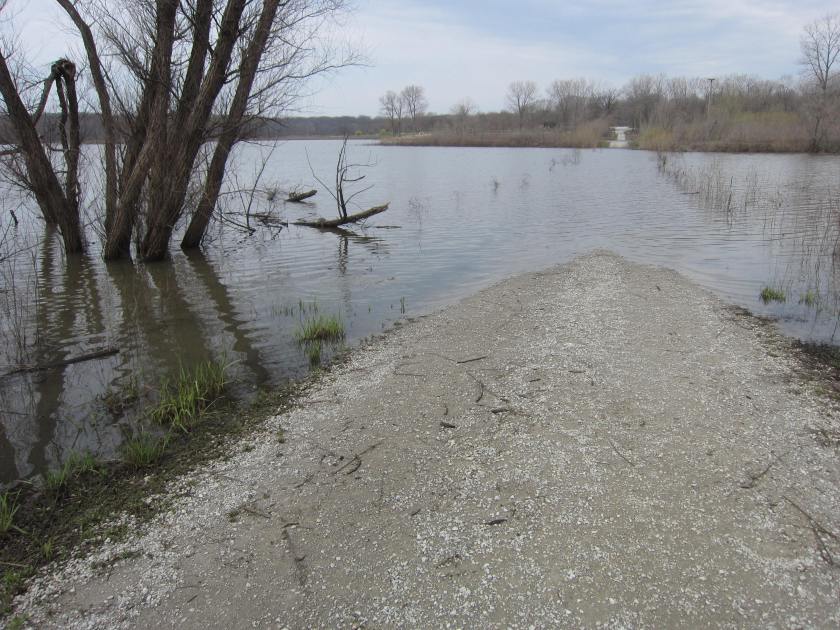
Periodically, the lake floods the gravel fire road that connects the southern and northern trails.
 Alternate routes, labeled “High Water Conditions“, are put into use when water is blocking the entrance to 101. If you park at the beach then you’ll need to ride back up the road to the high water specific entrance. You can also park at Sugar Bottom Rd and ride the southern trails and/or follow signs for high water access on the northern trails. The following Google Map shows two tracks: the left one was a ride on paved road to enter 102 via the high water entrance and the right one was the return path to that entrance using 105, 101B, 101, and 102.
The following picture shows the high water entrance located at the top of the hill along the paved road. From here, a short trail connected to 102.

105 was the starting point for a return path to the high water entrance.

The return path was well marked and contained a bi-directional segment on 101 from cyclocross hill to the long wood bridge. Only in times of high water conditions can this segment be ridden in the reverse direction and, thus, it was an opportunity to try something new. Next, follow signs for a grassy ride on 101b.

After 101B, you need to ride on 101 and follows signs on 102 to return to the paved road and ultimately the beach parking lot.
Wildlife


Whaaa…planning a hike to Cascade Falls in VA and found your blog. Now I find out you’re in my hometown! Oh how I miss the trails of Sugar Bottom! 302 ooh ooh! Thanks for all the info you share here.
Does the start of the 2012 Scramble go east or west?
John, I believe it started by riding east for a half-lap loop on the southern set of trails before starting a full lap heading west towards the northern set of trails.
Okay, thank you very much for the info. I plan to ride it with my friends just for fun.